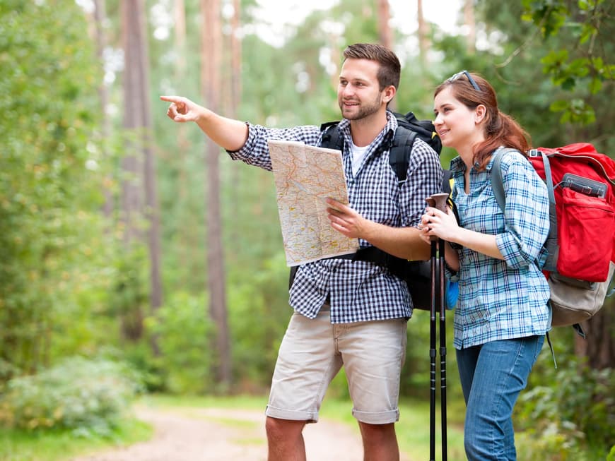
Hiking in Germany: a new trend?
According to a survey by the Federal Ministry of Economics, an incredible 40 million Germans relax in the great outdoors with our favorite pastime, 11 million of whom are drawn outdoors at least once a month. "The new desire for hiking has been clearly noticeable for a good 15 years. In recent years, more and more Germans have found hiking to be the ideal balance to their everyday lives," says Klaus Erber from the German Hiking Institute. And Thomas Bucher from the German Alpine Association also knows why hiking is increasingly becoming a mass phenomenon.
Where does the desire to hike come from?
There are several reasons: Firstly, there is a general outdoor trend - especially when it comes to clothing. As a result, the outdoors, i.e. being outside, has become a way of life. Secondly, people long for nature and freedom, which is what the mountains stand for. Financial considerations also play an important role: Hiking in Germany is considered inexpensive.
Why is hiking so healthy?
Because it is a gentle form of exercise that promotes fitness. In addition, being out in nature and experiencing beautiful things has a positive effect on the psyche. This makes it easy to switch off from everyday life. Hiking and wellness are the ideal combination for body and soul.
Can anyone go hiking?
That's the great thing about it: because it's so gentle, anyone can hike - regardless of age or weight. But of course you have to adapt hiking to your own physical condition. If you have joint problems, for example, you should use poles when walking downhill. You should also start with easy, short tours and then slowly build up. A two-hour hike is a good place to start.
What should your equipment look like?
Good footwear is very important. There is nothing worse than shoes that don't fit. That's why it makes sense to seek advice from a specialist store when buying shoes. As far as clothing is concerned, you should take a weatherproof jacket and warm clothing as well as a hat and sunglasses. The right size rucksack is important; a 20-liter rucksack is sufficient for a day hike. It should contain a first aid kit, a rescue blanket, some provisions and not to forget: enough drinks! For a two-hour hike, calculate one liter per person. You should have a cell phone with you for emergencies.
How do I recover afterwards?
If you have planned sufficiently in advance, you don't need to recover, even if the effort was great. This includes checking the weather forecast beforehand. If there are supposed to be thunderstorms in the afternoon, for example, you need to make sure you set off early so that you can get back in time. You should also plan a time buffer for the tour, as unforeseen delays can always occur. You will also avoid the famous sore muscles if you take precautions and don't do the big summit tour on the first day.
The most beautiful hiking routes in Germany
The Malerweg
Location: Elbe Sandstone Mountains in Saxony
Start and end point: Pirna-Liebethal and Pirna center
Length: 112 km, 8 stages
Highest and lowest point: Großer Winterberg at 556 m above sea level
and 113 m above sea level near Pirna
Info: www.malerweg.de
Highlights include Königstein Fortress, the Rathen rock stage and of course the Bastei - the most famous rock formation in Saxon Switzerland.
The Heidschnucken Trail
Location: Lüneburg Heath in Lower Saxony
Start and end point: Hamburg-Fischbek and Celle
Length: 223 km, 13 stages
Highest and lowest point: Wilseder Berg at 169 m above sea level
Info: www.heidschnuckenweg.de
Over a hundred small and large heathland areas, one regional and two nature parks - the Heidschnuckenweg trail attracts visitors with all kinds of natural beauty.
The Albsteig
Location: On the northern flank of the Swabian Alb in Baden-Württemberg and Bavaria
Start and end point: Tuttlingen and Donauwörth
Length: 350 km, 15 stages
Highest and lowest point: Lemberg at 1,017 m above sea level and Gingen a. d. Fils at 379 m above sea level
Info: www.schwaebischealb.de
Lush meadows, rugged rocks and fairytale castles can be seen along the Albsteig trail. Due to the sometimes narrow paths and steep climbs, some experience is required on this trail.
The Altmühltal Panorama Trail
Location: Along the winding course of the Altmühl river in Bavaria
Start and end point: Gunzenhausen and Kelheim
Length: 200 km, 15 stages
Highest and lowest point: Hahnenkamm near Spielberg at 656 m above sea level and Kelheim at 350 m above sea level
Info: www.naturpark-altmuehltal.de
Bizarre rock formations form a varied contrast to the juniper heath and forests. The highlight comes at the end: the spectacular Danube gorge at Weltenburg Abbey.
The Eifelsteig
Location: Eifel in North Rhine-Westphalia and Rhineland-Palatinate
Start and end point: Kornelimünster near Aachen and Trier
Length: 313 km, 15 stages
Highest and lowest point: Nerother Kopf at 647 m above sea level and Trier at 124 m above sea level
Info: www.eifelsteig.de
The Eifelsteig in the Volcanic Eifel is particularly exciting - the water of the maars there shimmers a deep blue - fantastic!
The Schluchtensteig
Location: Southern Black Forest in Baden-Württemberg
Start and end point: Stühlingen and Wehr
Length: 119 km, 6 stages
Highest and lowest point: Krummenkreuz hut at 1,148 m above sea level and Wehr at 346 m above sea level
Info: www.schluchtensteig.de
Gorges and gorges are followed by high moors and lakes, flower meadows and primeval forests - pure nature.
The Hochrhöner
Location: Rhön in Bavaria, Hesse and Thuringia
Start and end point: Bad Kissingen and Bad Salzungen
Length: 180 km, 8 stages
Highest and lowest point: Wasserkuppe at 950 m above sea level and Bad Kissingen at 210 m above sea level
Info: www.rhoen.de
The trail leads over the highest elevations of the low mountain range, the Ellenbogen, the Kreuzberg and of course the Wasserkuppe.
The Rothaarsteig
Location: Rothaargebirge in North Rhine-Westphalia, Hesse and Rhineland-Palatinate
Start and end point: Brilon and Dillenburg
Length: 154 km, 8 stages
Highest and lowest point: Langenberg at 843 m above sea level and Hofgarten in Dillenburg at 235 m above sea level
Info: www.rothaarsteig.de
With extended paths through the gorge-like Grubental valley and the mountains of the Hohe Westerwald, the route can be extended to 220 km.
The Moselsteig Trail
Location: Along the Moselle through Rhineland-Palatinate and Saarland
Start and end point: Perl to Koblenz
Length: 365 km, 24 stages
Highest point: 415 m between Schweich and Mehring
Info: www.moselsteig.de
Just opened, the trail accompanies the entire course of the German Moselle. The numerous viewpoints provide unforgettable views